Western Eyre Marine Park

Western Eyre is biologically rich and globally significant.
The diverse underwater landscape of Western Eyre Marine Park features canyons, ancient coastline and stretches of continental shelf break. These features drive nutrient-rich upwellings and eddies, creating areas of high biological productivity.
These productivity hotspots provide rich foraging grounds for a range of species including the Australian sea lion, sperm whale, white shark and small pelagic fish communities.
The seafloor also supports some of the world’s most diverse soft-sediment ecosystems that teem with rich invertebrate life.
Western Eyre Marine Park is adjacent to Murat Marine Park and three South Australian marine parks including Nuyts Archipelago, West Coast Bays and Investigator.
Together these marine parks connect coastal and offshore environments across state and Commonwealth waters and provide protection for a range of habitats and connected ecosystems.
The marine park is about 30 kilometres west of Streaky Bay, South Australia, and extends south to the edge of Australia’s Exclusive Economic Zone. It covers 57,944 square kilometres, with depths from 15 metres to over 6000 metres.
It has National Park, Multiple Use, Special Purpose and Special Purpose (Trawl) zones.
Explore
For recreational fishers, nearby Streaky Bay is a popular base. You can fish in many parts of the marine park and adjacent state marine parks. Check the zoning maps for details.
Find out more about the adjacent South Australian marine parks, including:
Discover
The marine park protects rich foraging grounds for a range of species including the Australian sea lion, sperm whale, white shark and small pelagic fish communities.
To discover more about the animals who call Western Eyre home, and the research we support to learn more about them, see the Research Voyages section.
Research voyages
In 2018, we participated in a research and monitoring voyage to discover more about the biodiversity in the marine parks.
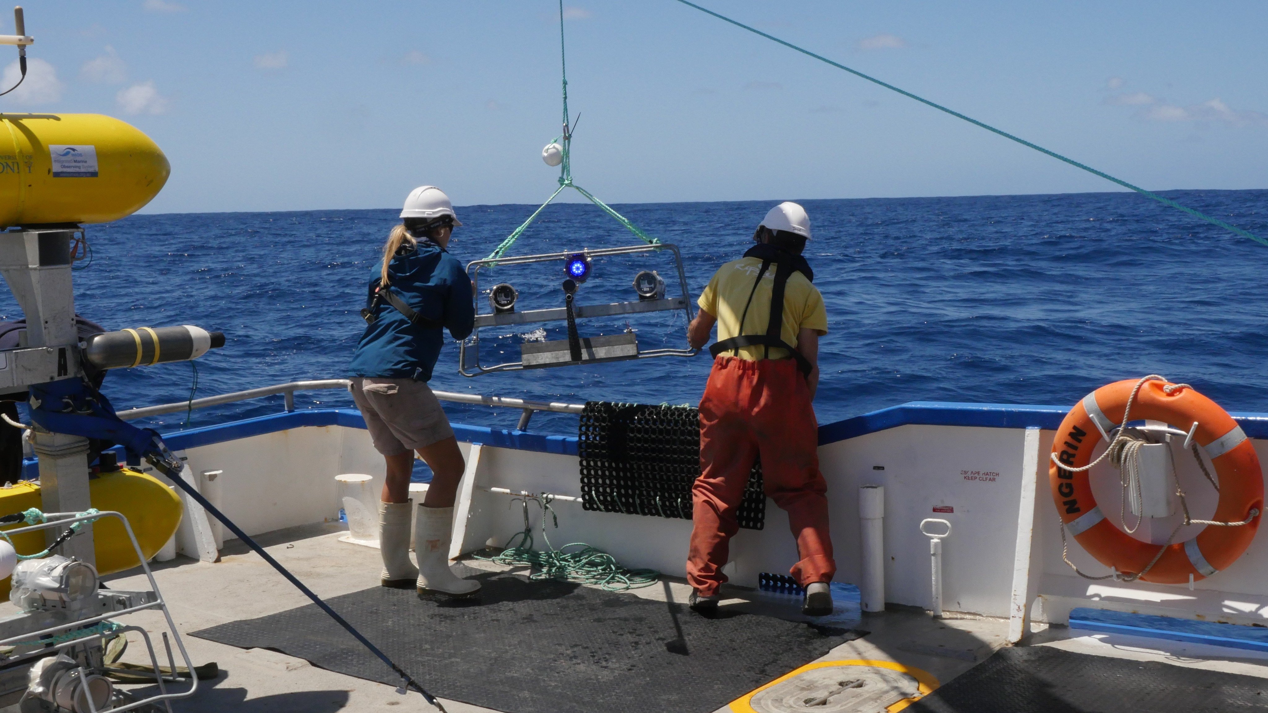
The 12-day collaborative expedition saw a multi-disciplinary research team led by South Australia’s Department for Environment and Water (DEW) in partnership with the South Australian Research and Development Institute, University of Adelaide, Flinders University, Integrated Marine Observing System and SA Environment Protection Authority.
The team set off aboard the Research Vessel Ngerin to undertake a range of activities in both Western Eyre Marine Park and South Australia’s Investigator Marine Park.
The team worked to gather baseline ecological data and undertake critical monitoring work. Over the course of the voyage, the team successfully undertook activities to map the seafloor, capture video of fish biodiversity, deploy acoustic receivers to track large predators, collect fish, invertebrate and sediment samples, and test for micro-plastic contamination.

The report and video below provide a great overview of the project and story of a successful collaboration:
Click on the map below to see what you can do in the Western Eyre Marine Park.
Download detailed map
Activities in marine parks
Allowed activities
Contact us
Learn about your marine parks


Stay in touch
Subscribe to receive important updates about your marine parks. Enter your email address and click "join now".